Heading out of the village of Gerolimenas, we knew
it was going to get even more remote.
Especially when you see a sign stating it’s the last fuel station - southernmost on the peninsula.
 |
| The cows just wander the roads in these parts |
A few kms down the road is Vathia, an old fortified settlement that is now
a ghost town. Restoration work started to take place but unfortunately fell into bankruptcy.
 |
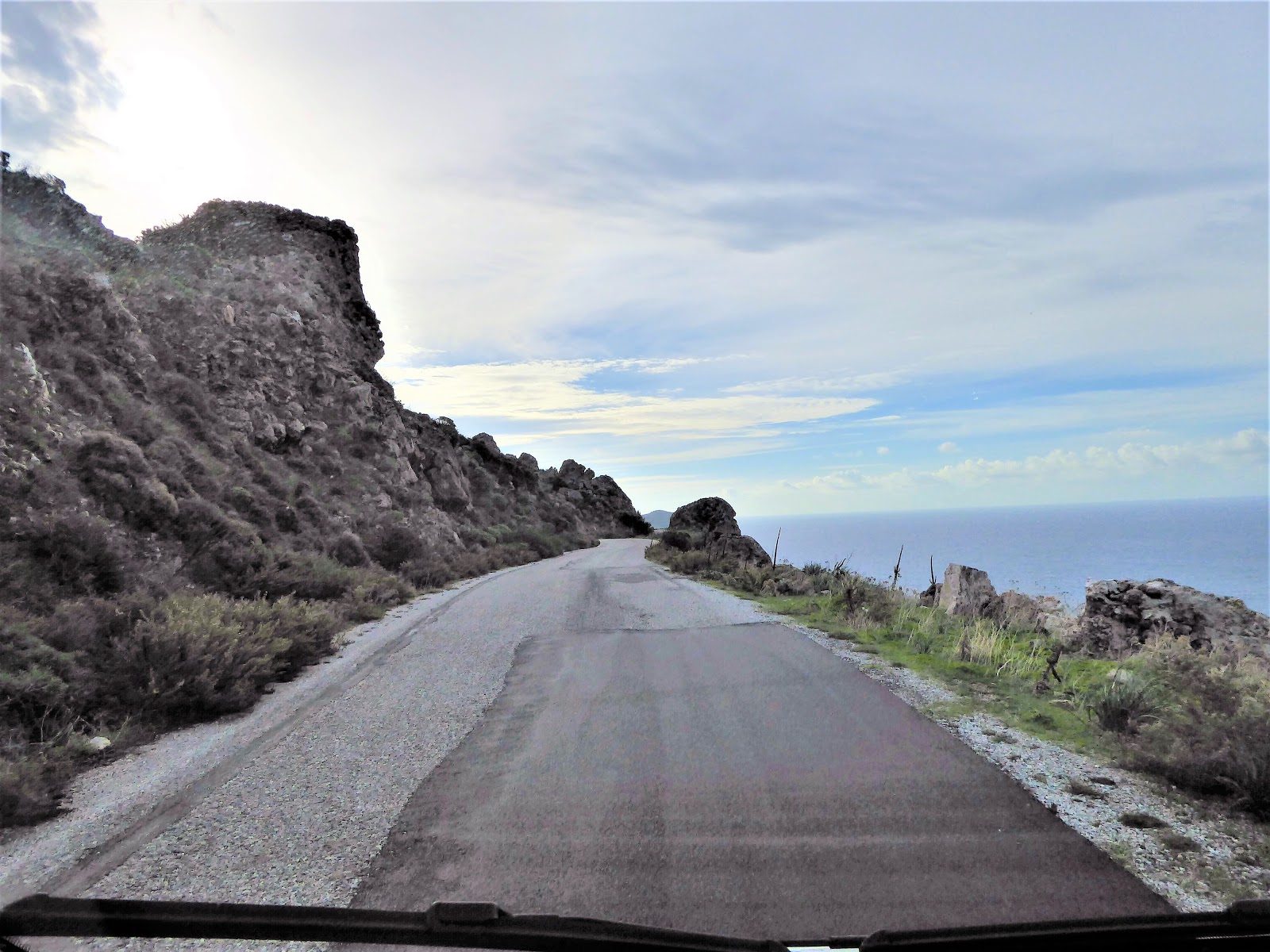
| The road is getting narrower – luckily, we didn’t pass any cars on the way |
It was only 17kms from Gerolimenas to Cape Tenaro but it took about 45 minutes to get there, as the roads are narrow and snake up and around the
hillside. There is a small waste area
at the end of the road, where you can park up and then you have to walk just over 2km over a rocky strip
of land to get to the lighthouse.
 |
| Cape Tenaro - the southernmost point of continental Europe |
 |
| Southernmost point of Mani - Cape Tenaro. It was a bit blowy and I was having a 'bad hair day'! |
The lighthouse was built in 1822 (since been restored) and marks
the end of Mani. It was named after the mythical hero Tenaros, son of Zeus and ancient Greeks believed that here were the gates to
the Underworld.
 |
| It's a popular shipping route, we saw quite a few tankers and container ships pass by |
 |
| These little flowers seem to be the only thing surviving on this barren strip of land |
 |
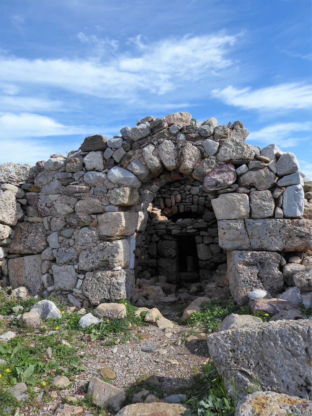
| Byzantine chapel of Agioi Asomatoi, built on the remains of the Sanctuary of Poseidon Tenarios |
 |
| Remains of a roman town, with mosaic said to date from the 1st century AD |
 |
| Red marks Cape Tenaro and our route in green on Mani (and part of the Peloponnese) |
Leaving the Cape, the road climbed steeply and poor old Sonny was in 2nd gear until we got to the top.
 |
| The end of Mani with Porto Kagio in the bottom, separated by the 2 gulfs - Messinian Gulf in the west and Laconian Gulf in the east. |
 |
| The snakes around more fortified villages |
 |
| Through yet more narrow streets – luckily there are hardly any cars on these roads! |
We didn’t know quite were we would stop but coming
into Kotronas
Bay we decided this was the one! We found a nice spot right on the harbour (N36.61847 E22.49439).
 |
| Sonny is parked up in the distance on the harbour |
 |
| A nice idea - free bikes to travel around on |
 |
| Those ancient Greeks must have been small to fit through this door! |
 |
| Wouldn't like to try and tackle this steep driveway to this house on the edge of the village! |
Not
sure the population of this village but we saw less than a dozen people all
day/night. It has a little mini market
and a lovey taverna at the entrance to the harbour where we enjoyed a delicious
Greek Pizza (everything you would find in a Greek salad, on top of a pizza and
baked in the oven). Needless to say, we were the only ones in there!
Leaving
Kotronas we filled up with the water tap at the harbour and headed off – destination unknown. Weather
started to warm up and so we decided to head for another beach.
 |
| As we started heading down this road we began to wonder where we would end up |
After a few scratches from the overhanging olive trees we
ended up at the very tiny village of Kamares (N36.67904 E22.52257) and parked up next to our first
motorhome we had seen in weeks - owned by Peter, who was from
Sweden. He told us that he had lived
in Greece for 8 years (2 years on Crete) and always spends the winter
here, as it is so peaceful. The locals know him and give him
water/facilities to use.
A
walk around the village led us to 2 Tavernas – closed! A handful of houses – empty of people! And what looked like an old campsite but is now overrun with wild animals, that outnumber the villagers!
 |
| Old campsite that looks more like a farmyard |
 |
| Mel heading out for his afternoon dip |
Tomorrow
we head to Gythio and probably on a campsite so we can do some washing.
Sally
x


No comments:
Post a Comment